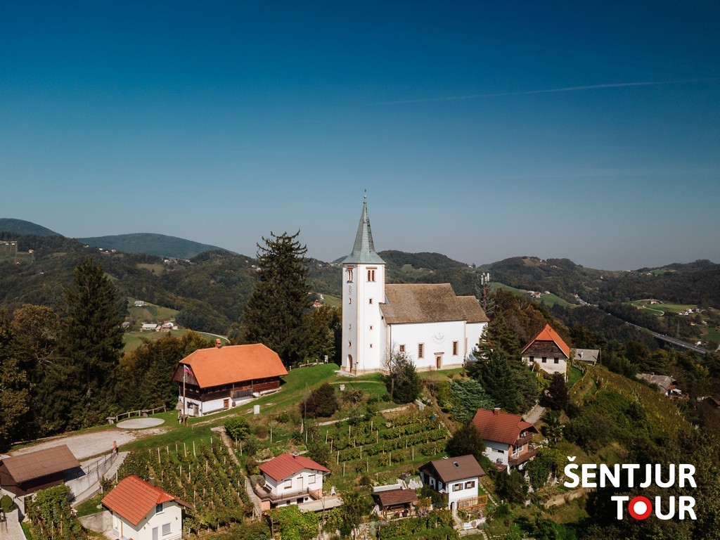
St. Ursula Hill above Dramlje is 464 meters high and easily visible from the Ljubljana–Maribor motorway. It is easily recognizable by its vineyards and numerous vineyard cottages, while on the hilltop stands the Renaissance-style Church of St. Ursula.
By the church, there is an exceptional viewpoint overlooking Celje, the eastern Celje Basin, and the hilly Kozjansko landscape to the south. You will also find the “bench of love” next to the church.
Trail Dramlje–St. Ursula
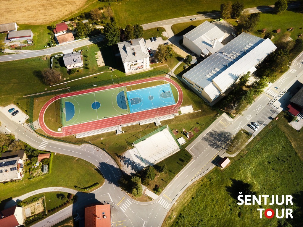
This easy hiking trail begins at Dramlje Primary School (Dramlje 7a), where free parking is available in the parking lot opposite the school. At the parking lot, you will also find a self-service shop and a bar. From the parking lot, walk past the bus stop and sports fields to the WWII monument, then turn right at the fire station. After descending to the Dramlje–Žiče main road, turn left. After about 300 meters, follow the trail markers and take the right turn. Cross the bridge and walk past the Church of St. Giles, then continue uphill along the paved road. When the slope levels out, you will see a sign “Sv. Uršula–Šedina.” Continue along the road, which ascents past a crossroad, leading up the hill to the Church of St. Ursula.
Short summary: Dramlje–St. Ursula
- Easy hiking trail
- Duration: up to 45 minutes (in one direction)
- Suitable for families with children, suitable for baby carriers
- Starting point: parking at Dramlje Primary School (free)
- At the starting point: self-service store and bar
- The trail is also suitable for cycling
Trail Dramlje–St. Ursula (via Šedina village)
This trail also starts at Dramlje Primary School (Dramlje 7a), with free parking opposite the school. At the parking lot, there is a self-service shop and a bar. From here, walk past the bus stop and sports fields to the WWII monument, then turn right at the fire station. After descending to the Dramlje–Žiče main road, turn left. After about 300 meters, follow the trail markers and take the right turn. Cross the bridge and pass the Church of St. Giles uphill. When the slope levels out, you will see the sign “Sv. Uršula–Šedina.” Turn right here and continue through the village of Šedina. In the forest, the trail joins Slomšek Pilgrimage Trail. From here, follow either the hiking or Slomšek trail markers. The path climbs left along the asphalt road, then continues across meadows and vineyards. At the junction with the asphalt road, turn right and shortly reach the Church of St. Ursula.
Short summary: Dramlje–St. Ursula (via Šedina)
- Easy hiking trail
- Duration: up to 1 hour (in one direction)
- Suitable for families with children, suitable for baby carriers
- Starting point: parking at Dramlje Primary School (free)
- At the starting point: self-service store and bar
Trail Hotunje (Ponikva)–St. Ursula
The trail begins at Ponikva railway station. From the station, go to the railway crossing and carefully cross the tracks. On the right-hand side of the road, you will see hiking signs, which you can follow, or continue along Slomšek Pilgrimage Trail. The trail runs along the railway on a paved road, then turns away from the tracks. At the next junction, follow the signs and turn right. The road climbs gently and, after leveling out, becomes a gravel road near a farm. Soon it leads through the forest, then to a small settlement. At the roadside chapel, watch for the signs that direct you through the yard of a homestead and onto a meadow path leading into the forest.
This section passes the scenic Kumperger Ponds, then continues through the forest to another chapel. From here, turn right along a gravel road to reach the village of Razbor. Turn left on the asphalt road through the village, then right again onto a gravel road, descending toward the motorway. Cross under the viaduct, pass over a narrow concrete footbridge across a stream, and continue along a meadow path into the village of Vodule. From here, follow the road past a ranch into the forest, then climb up the asphalt road. Trail markers direct you right onto a gravel road, then left uphill along a cart track, before joining the asphalt road again. When the road ends, the signs lead you across a meadow path through vineyards. At the asphalt road, turn right and soon arrive at the Church of St. Ursula.
Short summary: Hotunje (Ponikva)–St. Ursula
- Easy hiking trail
- Duration: 1 hour 30 minutes to 2 hours (in one direction)
- Suitable for families with children, suitable for baby carriers
- Starting point: Ponikva railway station (free parking available)
- Near the starting point, at the railway crossing, there is a local inn
Uršula Educational Trail
The Uršula Educational Trail leads from the Church of St. Giles in Šentilj hamlet (Dramlje) to the old sexton’s house (a lodge of the Dramlje Mountaineering Society) and on to the Church of St. Ursula on the hilltop, where you can enjoy views of the Celje Basin and Kozjansko region. Follow the markers leading across meadows and forest paths. Along the way, there are thematic points of interest.
Short summary: Uršula Educational Trail
- Easy hiking trail, 2.8 km long
- Duration: about 1 hour (in one direction)
- Designed for families with children, suitable for baby carriers
- Starting point: at the Church of St. Giles, with free roadside parking; or at Dramlje Primary School, about 500 m away
- The mountain lodge is open only during events organized by the mountaineering club
- In Dramlje, there is a self-service store, bar and an inn